By Susan Trask and Dana Little, June 21, 2012
Those of us who live around Taylor Pond will remember the first weekend of June, 2012 for a long time. We discovered that we live in a flood plain. Although heavy rains were predicted, none of us expected nearly nine inches in three days! Those of us who live on the north end experienced submerged docks, floating furniture and runaway boats. Those at the south end fared much worse, with houses surrounded by water, sump pumps useless, and sewage backing up through showers. The lake was quick to fill (it rose an estimated three feet in those three days), and, at this writing 10 days later, is just now receding to what we consider “normal” levels.
The prolonged flooding at the south end of the Pond provoked much conversation among waterfront property owners this year. Recurring speculation about a dam or dams preventing outflow resurfaced, and inquiries were made to the TPA Board about the flooding problem. Here’s a summary of the concerns expressed along with a little history and a bit of research.
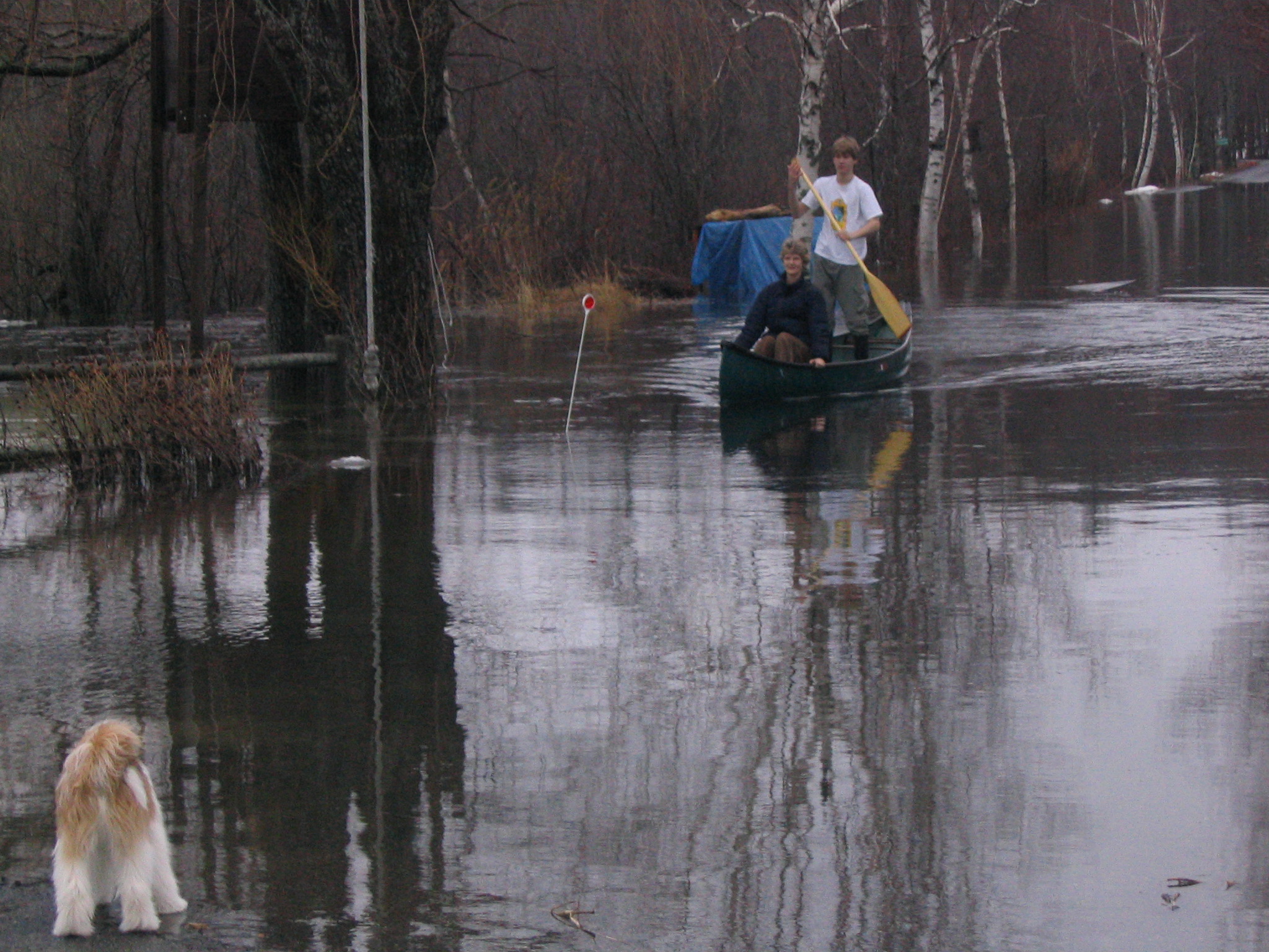
Canoes come out to get down the driveway during the flooding of April, 2005.
First, it should be noted that all of the properties located at the south end of Taylor Pond are within the 100-year flood plain. A look at FEMA’s recently updated flood plain map shows that Pondview Dr., Ledgeview Dr., Valview Dr., Chicoine Ave., and much of Garfield Rd. are within this area. The floodplain map may be viewed via the City of Auburn website. Although the recent 3-day storm was not of the “100-year” magnitude, it was the most significant (in terms of rainfall and water level) in about 25 years.
Many people have considered the outlet to be the source of high water. There have been reports of beaver dams and brush swept downriver that might clog up the drainage of water from the lake. In addition there has been concern that the dam located on Taylor Brook might impact the water level. When the state wildlife officials investigated several years ago they found no obstructing beaver dams, that Taylor Brook empties the pond unimpeded and that the dam on Taylor Brook does not affect the water level in Taylor Pond.
Anyone who has tried to navigate through the outlet has found that it’s extremely overgrown and congested. In 1974 a group from the Taylor Pond Association mounted a clean-up effort there, which resulted in the removal of huge amounts of trash and debris. Although the area was undoubtedly improved by the action, residents found very little difference in the water level. People have proposed dredging the outlet to lower the pond’s water level or requesting a lower level on the Taylor Brook dam downstream.
According to Jim Glasgow of the Maine DEP, any alteration in Taylor Pond’s water level from dredging, installation of a new dam or alteration of the Taylor Brook dam would require a permit. A consensus of homeowners on the Pond would have to agree to and pay for the permit process and project. At a minimum a project like this would take the services of an engineer to design the method, a biologist to assess the environmental impact and a construction firm to carry out the process.
Sabbatus Pond provides an example of the regulatory process. In 1978 the DEP first started the assessment process issuing their order after 11 years of deliberation. In order to develop a consensus many public meetings occurred in which they considered spawning grounds, alewife stocking, migration of eels, replenishment of water in marshes, recreational fishing, duck hunting, access to boat ramps, swimming, dock installations, flooding from water releases, prevention of damage from ice formation, algal blooms and finally the interests of homeowners in preventing flooding. Once the DEP evaluated all of these issues they came up with an order that established lake levels that varied with the season. Failure to adhere to the order at any time in the future would result in the dam being fixed at a set level potentially leaving Sabattus Pond even more vulnerable than Taylor Pond to flooding.
Installing a dam can actually worsen flooding. Engineers design dams to manage up to a certain water level. Above that water level, dams restrict the exit of water which increases flooding during a torrential downpour. For example, on Patriot’s day in 1997 Panther Pond flooded following a heavy rain because the dam restricted outflow. It took two weeks after the storm for the water levels to return to normal. The Dead River dam provides another example of what occurred during the June 2012 rainstorm. Mark Margerum, at the Maine DEP, reports that the dam increased flooding around Androscoggin Lake by restricting water outflow. According to Jim Glasgow also at DEP, the dam into the Presumpscot River limited the outflow of water from Lake Sebago causing many properties to flood during the same June downpour that affected us.
Unfortunately with heavy rainfall many properties in the flood zone will continue to flood. Taylor Pond Association does not regulate the level of the pond. Streams, springs and rainfall all raise the pond level. Water exits the pond by Taylor Brook and evaporation. Artificially altering lake levels requires a costly, complex and lengthy consensus process that considers many factors besides flooding. Dredging, cleaning the outlet, building a dam or altering existing dam levels will not prevent flooding from an unusually heavy rainstorm. We wish there were an easy answer but there is no simple solution to protect homes in a flood zone.